France into Spain, in the order the yellow arrows walk it — the one route in this section with no single life to follow, because the pilgrim of this story is everyone who has ever walked it.
How this route works — and what we refuse to print. The stops follow the French Way (Camino Francés) in road order. Pilgrimage literature commonly measures the full walk at roughly 780 km from Saint-Jean-Pied-de-Port; how many days it takes is yours — legs, weather and heart decide — so this page deliberately prints no day counts and no stage promises, and describes the road in sections instead. The one number we do quote is the Pilgrim Office's own rule for the Compostela (the last 100 km on foot), attributed to the office where it appears. The road and several of its cities carry UNESCO listings; where that is a fact it is marked as one — the Camino needs no borrowed glory. Affiliate note: the “Plan this stop” boxes carry affiliate links (marked; you pay the same) and official links (marked “Official link”) — no provider paid for a stop to be included.
Your pilgrim stamps — 0 of 10 stops
Stamps live only on this device (browser local storage, key pilgrimage_stamps_v1) — never sent to a server, and they work offline. A small echo of the credencial in your pocket — and, like it, only honest if you walked.
STOP 1The Pyrenees
Saint-Jean-Pied-de-Port — The Gate of the Pyrenees
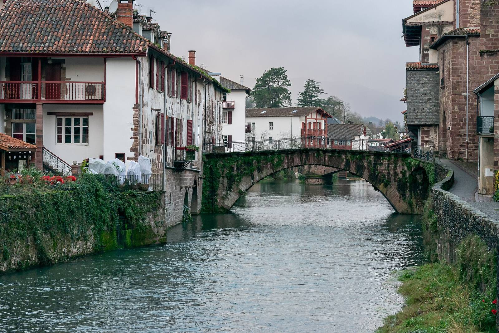
The French Way begins — by long custom, not by rule — in Saint-Jean-Pied-de-Port, a small Basque town in the French Pyrenees where several of Europe's older pilgrim roads once converged. Pilgrims collect a credencial, the pilgrim passport that will gather stamps all the way to Compostela, and walk out through the Porte Saint-Jacques over the little River Nive in the photograph. The town and its gate sit on the French listing of the Routes of Santiago de Compostela in France — the road's own heritage status starts at its first bridge.
Why it matters: every long road deserves a small gate: this is the Camino's — a river, a passport, and the first stamp of hundreds.
🏛️ Factual link: the Routes of Santiago de Compostela in France are a UNESCO World Heritage listing (inscribed 1998); the Porte Saint-Jacques here is one of its named landmarks. See the collection →
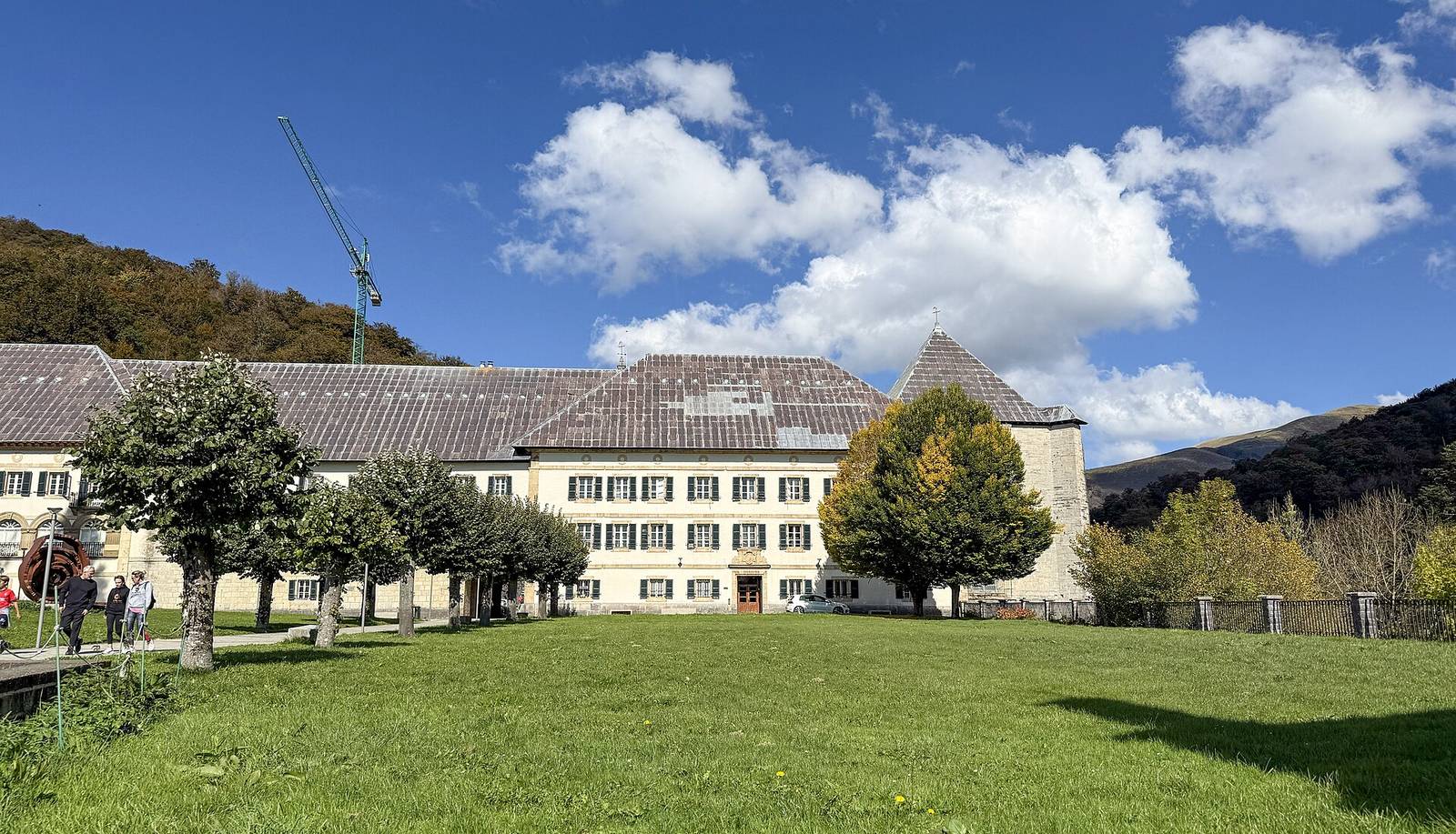
The first day's climb crosses the Pyrenees — most walkers by the Napoleon route over the Lepoeder pass, weather deciding for them, as it always has — and comes down to Roncesvalles (Orreaga), where a great Augustinian collegiate church and pilgrim hospital have received the road's travellers since the twelfth century. The valley carries an older fame: Charlemagne's rearguard and Roland died in this pass in 778, the seed of the Song of Roland. The collegiate church in the photograph is where most pilgrims sleep their first Spanish night, a few hundred metres from the border they crossed on foot.
Why it matters: Roncesvalles is the road's threshold: one hard day behind you, a country of walking ahead, and a church built for exactly that exhaustion.
Pamplona is the first real city of the French Way — Roman-founded, walled, and famous worldwide for July's running of the bulls, which the Camino politely ignores eleven months a year. Pilgrims enter through the old gates, pass the Gothic cathedral in the photograph, and walk streets Hemingway later made famous for a different festival. For this route, Pamplona matters as the road's first urban lesson: the Camino is not wilderness walking — it threads cities that have hosted pilgrims for a thousand years, and its cafés, hostels and stamp-giving churches are a civilisation of the road.
Why it matters: the first city teaches the road's social contract: towns feed walkers, walkers bring towns to life — an economy of kindness a millennium old.
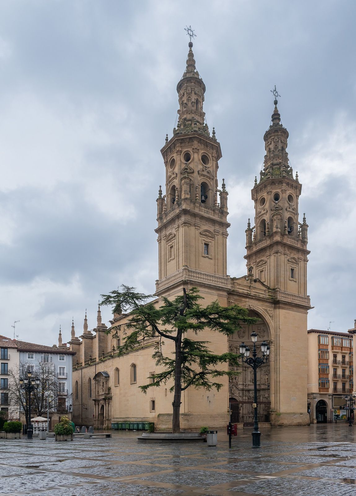
West of Pamplona the road crosses into La Rioja at Logroño, over the stone bridge across the Ebro. The cathedral of Santa María de la Redonda — its twin towers in the photograph — stands a street away from Calle Laurel, the tapas street where pilgrims traditionally celebrate reaching wine country. We make no claim about prices or pours; the honest label for this stop is simpler: from here to Burgos the Camino walks through one of Europe's old wine landscapes, and the road's meseta openness begins to gather ahead.
Why it matters: Logroño is the road's table stop: pilgrimage has always been walked on bread and welcome as much as on faith — this city serves both.
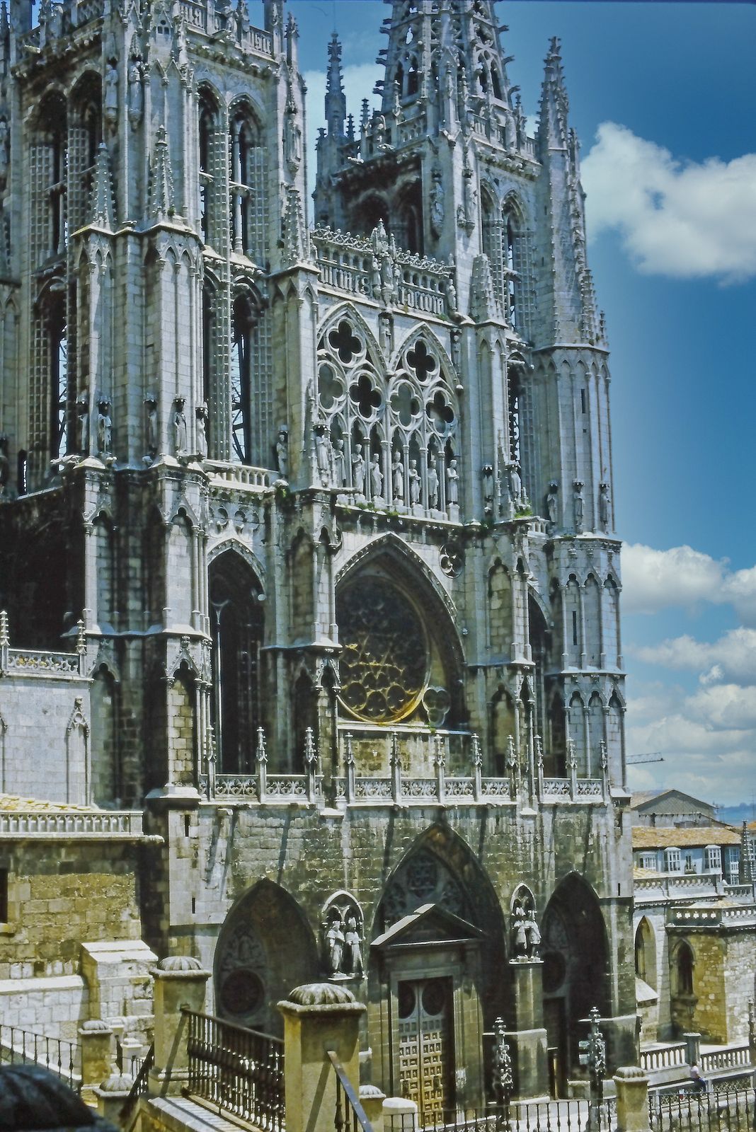
Burgos is the French Way's first great cathedral city. Its cathedral — begun in 1221 — is a masterpiece of Spanish Gothic and a World Heritage site in its own right; El Cid is buried beneath its crossing. Pilgrims reach it after the long approach across the Montes de Oca, and the city's scale comes as a shock after weeks of villages: spires, a river promenade, and the road's most famous pilgrim hostel tradition in the old town. The cathedral's west front in the photograph has been the road's halfway landmark in spirit — not in distance — for eight centuries of walkers.
Why it matters: Burgos is where the road shows its cathedral scale: the Camino built cities as much as cities hosted the Camino.
🏛️ Factual link: Burgos Cathedral is itself a UNESCO World Heritage site (inscribed 1984). See it in the collection →
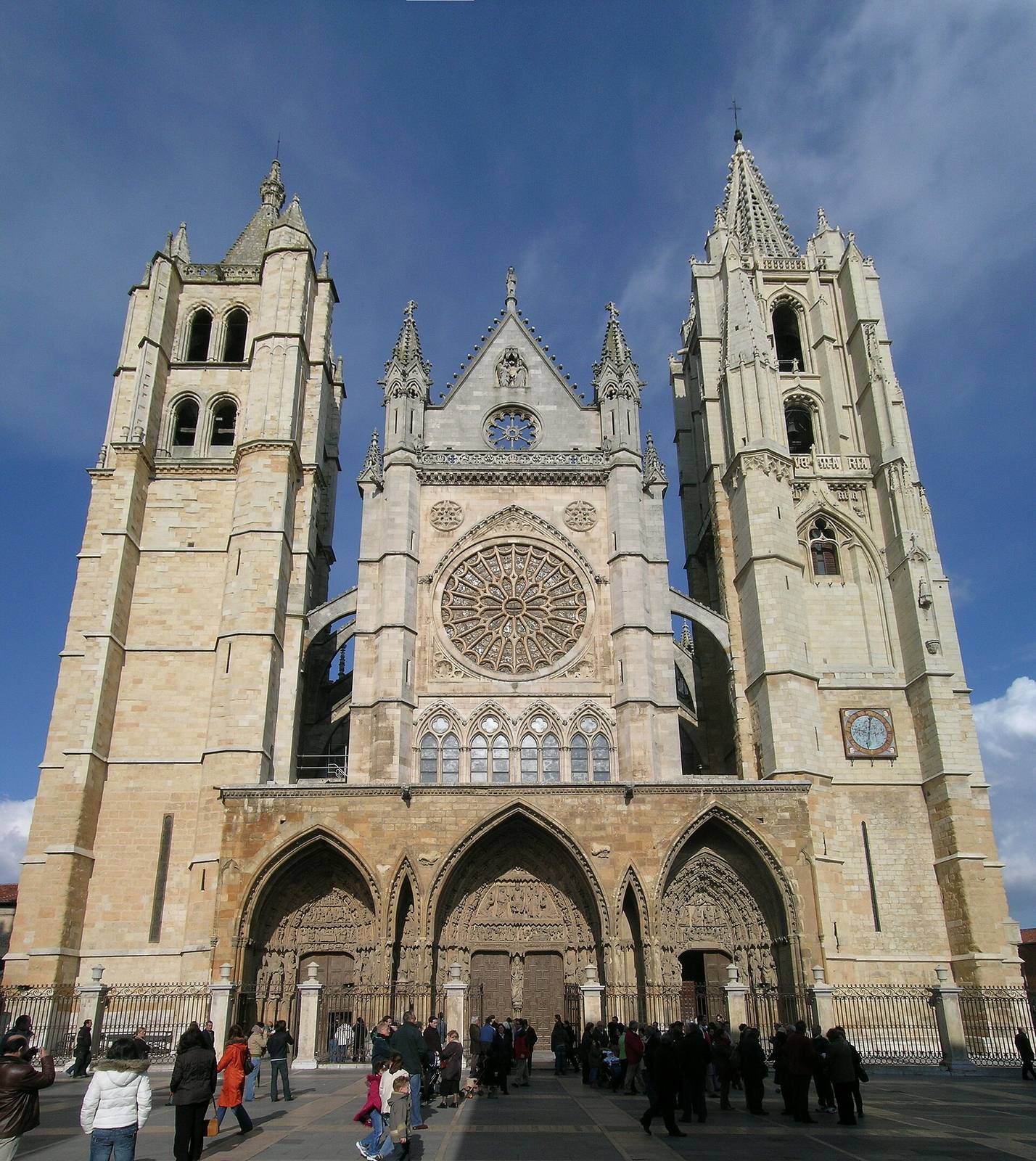
Across the high meseta — the road's famous flat, sky-heavy middle, walked in sections and never honestly promised in days — lies León. Its cathedral, the Pulchra Leonina, is a thirteenth-century essay in stained glass: over a hundred windows that turn the interior into coloured light, as in the photograph. Beside the road León also keeps San Isidoro, with its royal pantheon and Romanesque frescoes, and a old town that feeds walkers well. Pilgrims have called León the Camino's second city of light for good architectural reason.
Why it matters: León is the meseta's reward: days of horizon, then a building made of light — the road's rhythm of effort and gift in one city.
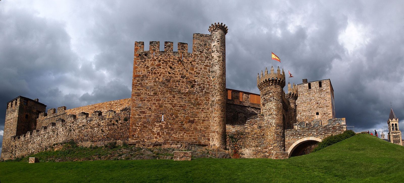
At Ponferrada the road enters El Bierzo, a green bowl of hills before Galicia, under the vast castle the Knights Templar held from the twelfth century to protect this very road — the fortress in the photograph, still the town's silhouette. Pilgrims in the Templars' centuries walked under armed protection here; today's walkers get a museum and the Iron Cross ahead of them at the road's highest point, where tradition has pilgrims leave a stone carried from home. The tradition is living custom, labelled as such: nobody verifies your stone.
Why it matters: Ponferrada is the road's guardian stop: proof that this pilgrimage was once dangerous enough to need knights — and that protection of pilgrims is an idea with a castle.
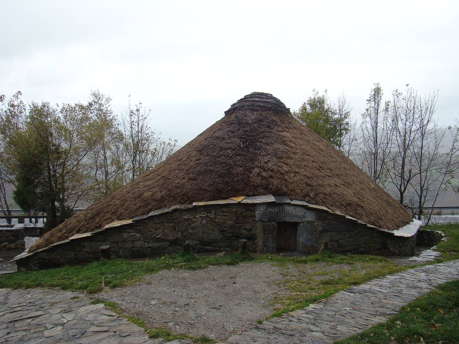
The road climbs once more, into Galicia, and its first Galician village is O Cebreiro — a hamlet of pallozas, the thatched stone roundhouses in the photograph, some lived in into living memory. Its little pre-Romanesque church of Santa María keeps a chalice tied to a eucharistic miracle tradition of the fourteenth century — told here as the tradition tells it. In the revival of the modern Camino, this village also honours Don Elías Valiña, the parish priest who painted the yellow arrows that now mark the whole road: his grave is here, and the arrows pilgrims follow began with his paintbrush.
Why it matters: O Cebreiro is the road's marker stop: a stone village, a priest with a pot of yellow paint, and the moment the modern Camino was quite literally signposted back to life.
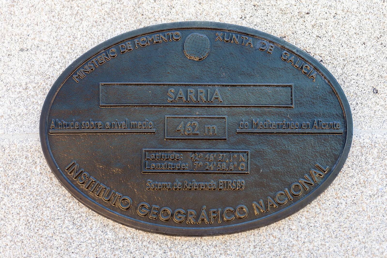
Sarria is the French Way's great junction of intentions: the Cathedral of Santiago's Pilgrim Office issues the Compostela certificate to walkers who complete at least the last 100 kilometres on foot (the office's own published rule, quoted as theirs), and Sarria sits just beyond that line — so a large share of all pilgrims start here. The old town climbs from the river to the church of Santa Mariña and the ruins of its castle tower. Purists who walked from France can grumble; the road, characteristically, just makes room. This stop honours the short-walk pilgrims too: a hundred honest kilometres is not a small thing.
Why it matters: Sarria is the road's democracy stop: eight hundred kilometres or one hundred, the same yellow arrows, the same stamps, the same cathedral at the end.
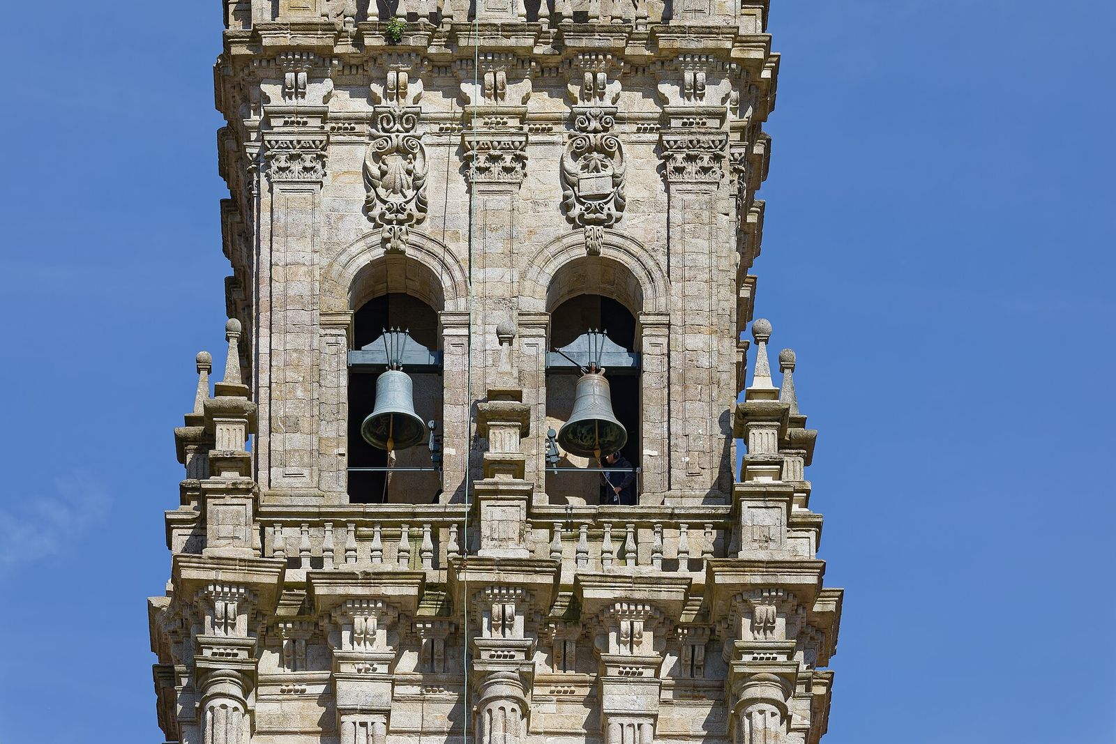
The road ends — as it has since the ninth century, when a tomb identified by the local bishop as the apostle James's drew the first pilgrims across a continent — at Santiago de Compostela. The identification is the tradition on which the entire Camino stands, and this page states it in exactly those terms. Pilgrims enter the Praza do Obradoiro beneath the cathedral's baroque towers in the photograph, attend the Pilgrims' Mass, embrace the apostle's statue, descend to the silver tomb, and collect the Compostela with their Latinised name. The old town around the cathedral is a World Heritage site; the botafumeiro still swings on great feasts. Whatever brought a walker here — faith, grief, sport, curiosity — the square makes no distinction, and neither does this page.
Why it matters: the end of the road is a beginning's shape: a tomb, a certificate, and a square full of people who cannot quite believe they walked here. Ultreia — onward — is the pilgrims' own word for what happens next.
🏛️ Factual link: Santiago de Compostela (Old Town) is a UNESCO World Heritage site (inscribed 1985), and the Camino Francés itself is inscribed as part of the Routes of Santiago de Compostela listing (1993, extended 2015). See the collection →