

🌴 Miami & Miami Beach — two cities, one trip, planned honestly
Almost every Miami mistake starts with the map in the visitor's head, so this page starts by correcting it. Miami Beach is not a neighbourhood of Miami: it is a separate city on a barrier island, with its own streets, its own free trolley and its own Art Deco oceanfront. Miami is the mainland city across the causeways — downtown, Brickell, Little Havana, Wynwood — with a transit system of its own, including a genuinely free downtown circulator. Between them, on its own island in the bay, sits PortMiami, one of the busiest cruise ports on earth, whose terminal — not its city — is what your sailing day actually depends on. And beyond the urban edge, two national parks frame the trip: the Everglades to the west and Biscayne, which is mostly water, to the south. Plan those four layers separately and Miami becomes legible. Blend them and every day starts with a causeway. No prices are stated anywhere on this page; the fares and fees that exist are stated by the operators, on their own pages, for your date.
First, the separation — beach, mainland, port, parks
This table is the page. Everything after it is detail. Four layers, four different logics — and the two questions that decide most Miami days (which side do I sleep on, and which terminal does my ship use) are answered here, not at the end.
| Layer | What it actually is | Its own system | The classic mistake |
|---|---|---|---|
| Miami Beach (the island city) | A separate city on a barrier island: South Beach and the Art Deco Historic District, Mid-Beach, North Beach | The City of Miami Beach's own free trolley — four routes covering South, Middle and North Beach and a Collins Avenue express | Assuming it is a district of Miami, and that Miami's transit (or its free trolley) reaches it |
| Miami (the mainland city) | Downtown, Brickell, Little Havana, Wynwood, Coconut Grove, the airport side | Miami-Dade Transit: Metrorail, Metrobus — and the Metromover, a free automated circulator on three downtown loops | Sleeping here for a beach holiday and paying for it in causeway crossings every single day |
| PortMiami (Dodge Island) | The county's cruise port on its own island between downtown and the beach, reached by the port causeways | Cruise terminals lettered A to J plus V and AA, each line-assigned, each with its own address and parking | Going to "the port" generically — the terminal on your documents is the destination, and terminals sit at different ends of the island |
| The park radius (day trips) | Everglades National Park to the west and south; Biscayne National Park, mostly water, at Convoy Point | National Park Service entrances and programs — three separate Everglades entrance areas, and a boat-based Biscayne | Treating "the Everglades" as one gate, or Biscayne as a beach you drive to |
The island city — Miami Beach
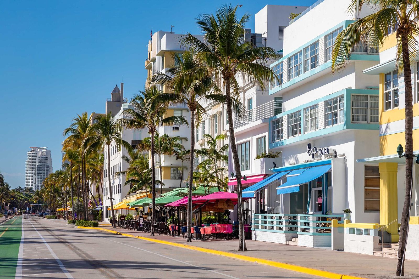
Miami Beach — the city on the barrier island Separate city — free trolley, Art Deco oceanfront
Strengths
- It runs its own visitor infrastructure with unusual generosity: the City of Miami Beach's trolley is free, runs four routes — South Beach loop, Middle Beach loop, North Beach loop and a Collins Express — across the island's whole length, daily, on the city's published pattern; on-demand Freebee rides cover parts of Mid and North Beach
- The South Beach core is America's great walkable beachfront: the Art Deco Historic District along Ocean Drive, the beach itself across the street, and a street grid that works entirely on foot once you are based inside it
- As a base it removes the causeway from the beach equation completely — the beach is your street, not your excursion
Watch out
- The two cities' free systems do not connect: Miami Beach's trolley stays on the island, Miami's Metromover stays downtown, and no free ride crosses between them — the crossing is a bus (the airport express route serves the beach), a taxi or a rideshare, and it is a real leg of the day
- Ocean Drive's fame cuts both ways: it is the postcard and the price premium at once, and the quieter, often better beach days live up the island in Mid and North Beach — which is what the trolley's other three routes are for
- Beach conditions and lifeguard coverage are the City of Miami Beach's posted, day-by-day facts — check them on the day rather than inheriting them from a guide written in another season
Best for: the beach-first base — and the right answer for any trip whose centre of gravity is the sand.
See the City of Miami Beach →Official site Browse Miami tours →Affiliate link — you pay the same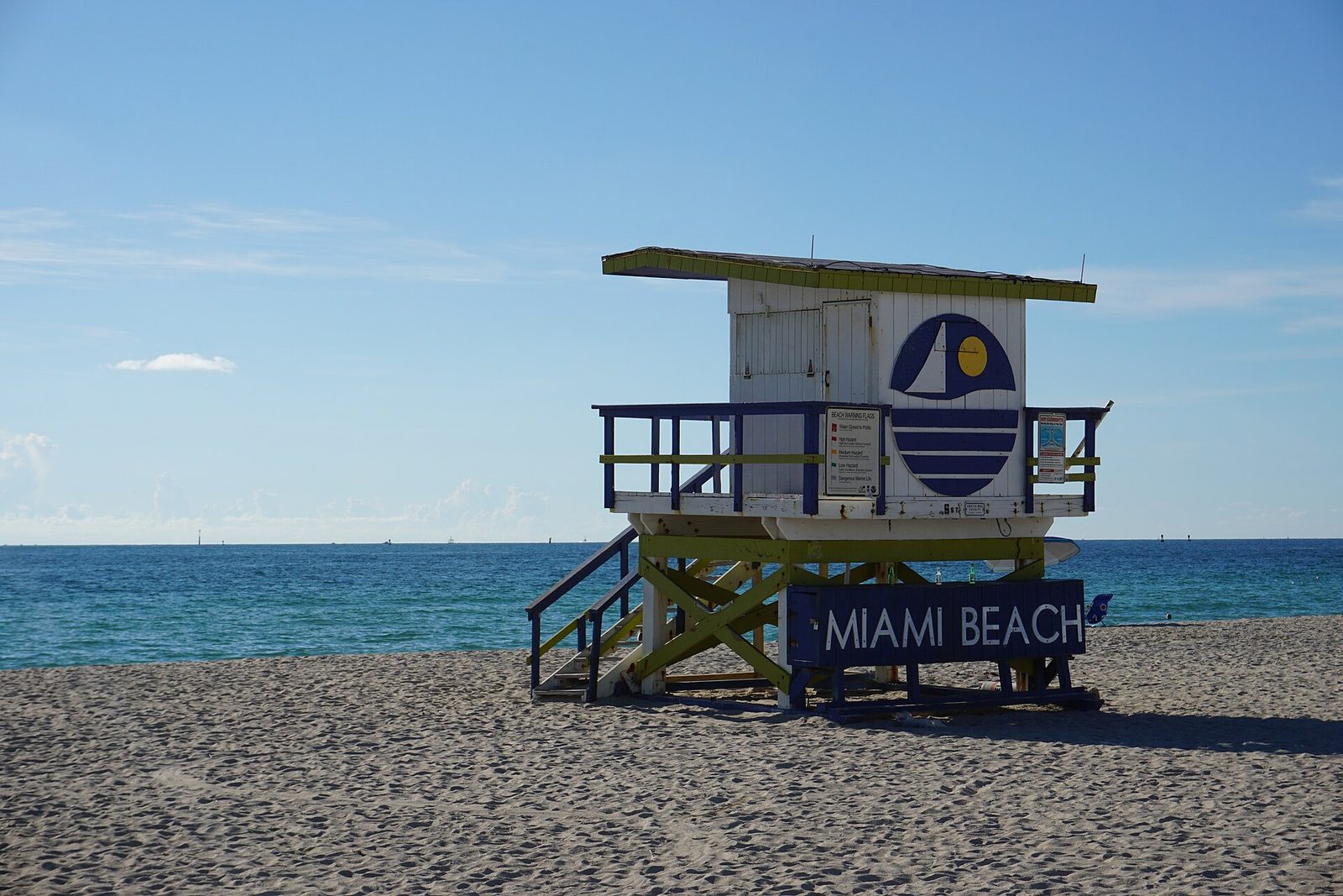
The beach day itself — South Beach and up the island The sand layer — conditions are daily facts
Strengths
- The beach is one long public strand with distinct moods by latitude: the Art Deco theatre of South Beach, the hotel row of Mid-Beach, and the local, park-like calm of North Beach — the trolley's four routes exist precisely to let you choose among them without a car
- The iconography is real and close together: lifeguard towers, pastel facades and the ocean in one frame, on an ordinary morning walk
- Sunrise is this coast's free spectacle — the beach faces east, the towers and the Deco skyline light up first, and the crowds have not yet arrived
Watch out
- This is an ocean beach with ocean conditions: currents, surf and weather are assessed daily by the city's lifeguard service, and the posted flags and warnings on your day outrank anything printed here
- The South Beach scene has a nightlife economy layered over the sand — the Greater Miami Convention & Visitors Bureau promotes the city's dining and nightlife at destination level for a reason; pick your stretch of the island to match the trip you actually want
- Shade is not provided by geography: the strand is wide and exposed, and the midday hours are a plan (lunch, a museum, the trolley north), not an endurance test
Best for: building the trip's rhythm — beach mornings on the island, mainland layers on the other days.
See the Greater Miami visitor bureau →Official siteThe mainland — city layers
Downtown & Brickell — and the free Metromover Mainland core — fare-free circulator
Strengths
- The Metromover is the single most useful transit fact in Miami: Miami-Dade Transit's own pages state it plainly — the automated downtown circulator is free for everyone, running three loops (the inner loop, the Omni loop north and the Brickell loop south) across 21 stations, and transferring to Metrorail at Government Center and Brickell stations
- The core it serves is the city's working-and-going-out downtown: Bayside and the bayfront, the Brickell financial district's towers and dining, and the cultural venues along the Omni side — a complete city day inside the free loop's footprint
- It is also the cruise passenger's friend: downtown and Brickell are the mainland face of the port, and a pre- or post-cruise night here puts the port causeway, not a cross-metro trek, between you and the ship
Watch out
- Free has a precise boundary: the Metromover is the fare-free service. Metrorail and Metrobus are paid systems — the county's fare information lives on its own pages, and this page's rule is to state the boundary, not the amounts
- The loops serve the downtown core only: Little Havana, Wynwood and the beach are all outside the Metromover's map, each a separate transit or road decision
- Downtown keeps business-district rhythms — Brickell at full hum on a weekday, quieter pockets on a Sunday morning; it is a city centre, not a resort strip, and rewards being visited like one
Best for: the mainland base — especially for cruise pairings and city-first trips that will visit the beach rather than live on it.
See Miami-Dade Transit →Official site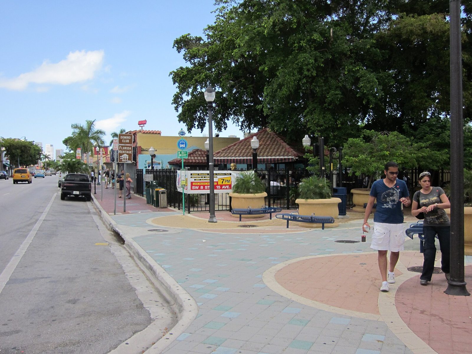
Little Havana & Calle Ocho Mainland neighbourhood — walkable core
Strengths
- A living neighbourhood, not a theme: the Greater Miami visitor bureau's own guide centres it on Calle Ocho — Southwest 8th Street — with the walkable core around Maximo Gomez Park (Domino Park) and the blocks near Southwest 12th to 17th Avenues, where the domino tables, cigar shops, cafeterias and the Walk of Fame sit within an easy stroll
- It has a proper visitor anchor: the Little Havana Visitor Center on Calle Ocho itself, run as the neighbourhood's front door — its stated hours vary, so treat arrival as flexible and the street as the exhibit
- It eats better than anywhere else in this guide per block: ventanita coffee windows, bakeries and family restaurants are the itinerary here, and they need no booking system at all
Watch out
- It is a residential and working neighbourhood wearing fame lightly: beyond the Calle Ocho core it is ordinary city blocks, and the respectful visit is a daytime, on-foot one inside the core the bureau itself maps
- No transit headline gets you here: the Metromover does not reach it, so the trip is a Metrobus or a rideshare from downtown — short, but a decision, not a stroll
- Festival days (the famous Calle Ocho celebrations) transform the street entirely — glorious if intended, a closure map if not; check the bureau's calendar against your dates
Best for: the food-and-culture half day — paired with downtown, and deliberately unhurried.
See the visitor bureau's Miami neighbourhoods →Official site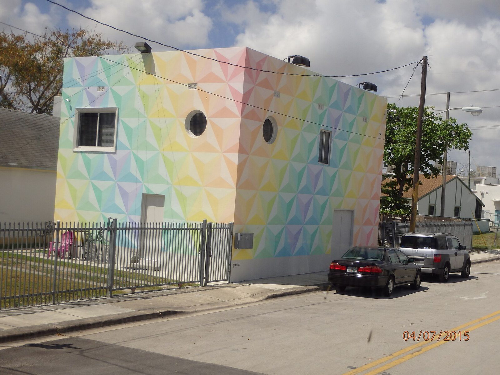
Wynwood & the arts districts Mainland — the mural quarter
Strengths
- The mainland's creative quarter: a warehouse district turned open-air gallery, where the murals are the streetscape and the galleries, breweries and food halls fill the blocks between them — the visitor bureau promotes it as one of the city's signature neighbourhoods
- It pairs naturally in sequence: Wynwood by day, then the downtown–Brickell core for the evening, without crossing to the island at all
- For repeat visitors it is the layer that changes fastest — new walls, new venues — which makes it the refresh day of a Miami return
Watch out
- Its anchors are commercial and its hours are business hours: the famous walled garden at its centre is a ticketed attraction with its own calendar, and the district quiets early in the week — go on the district's rhythm, not yours
- Like Little Havana, it has no rail headline: buses and rideshares are the connection, and the blocks around the core are a working warehouse district
- We name no venues and rank nothing here — the scene turns over too fast for print; the bureau's neighbourhood pages are the current layer
Best for: the art-and-food day of a mainland-based trip — and the strongest non-beach afternoon in the city.
See the visitor bureau →Official siteThe port and the parks
PortMiami — read your terminal, not the skyline Cruise port — county-run, terminal by terminal
Strengths
- The county publishes the port properly: Miami-Dade's PortMiami pages assign every terminal to its lines — Terminal AA for MSC (opened 2025, which the county describes as the world's largest cruise terminal), A for Royal Caribbean, B for Norwegian, D, E and F for Carnival, V for Virgin Voyages, J for boutique and small luxury ships, C as a multi-line terminal — each with its own address, directions and parking page
- The geography is kind: the port sits on Dodge Island immediately off downtown, so a downtown or Brickell night before sailing is a causeway, not a commute — and Miami Beach is the other causeway when the beach calls
- For the Orlando pairing, the transport spine exists: Brightline's downtown Miami station and the MCO station tie the port to the theme-park city by rail, the classic Florida combination trip
Watch out
- "PortMiami" is not an address: the terminals are spread along the island, each line sails from its own, and the only authoritative version is the terminal printed on your cruise documents — guides (including this one) are orientation, documents are law
- The port is mid-build: Royal Caribbean's Terminal G has been under construction since summer 2025 with the county presenting it as a future facility — line assignments and terminal arrangements can shift with the works, which is another reason the documents rule
- Parking, drop-off and ground transport differ by terminal on the county's own pages; a sailing-day plan made from a generic port map is a plan made to be re-made at the causeway
Best for: every cruiser — read this card, then your documents, then the county's page for your terminal, in that order.
See PortMiami's cruise terminals →Official site Compare cruises on the hub →Hub comparison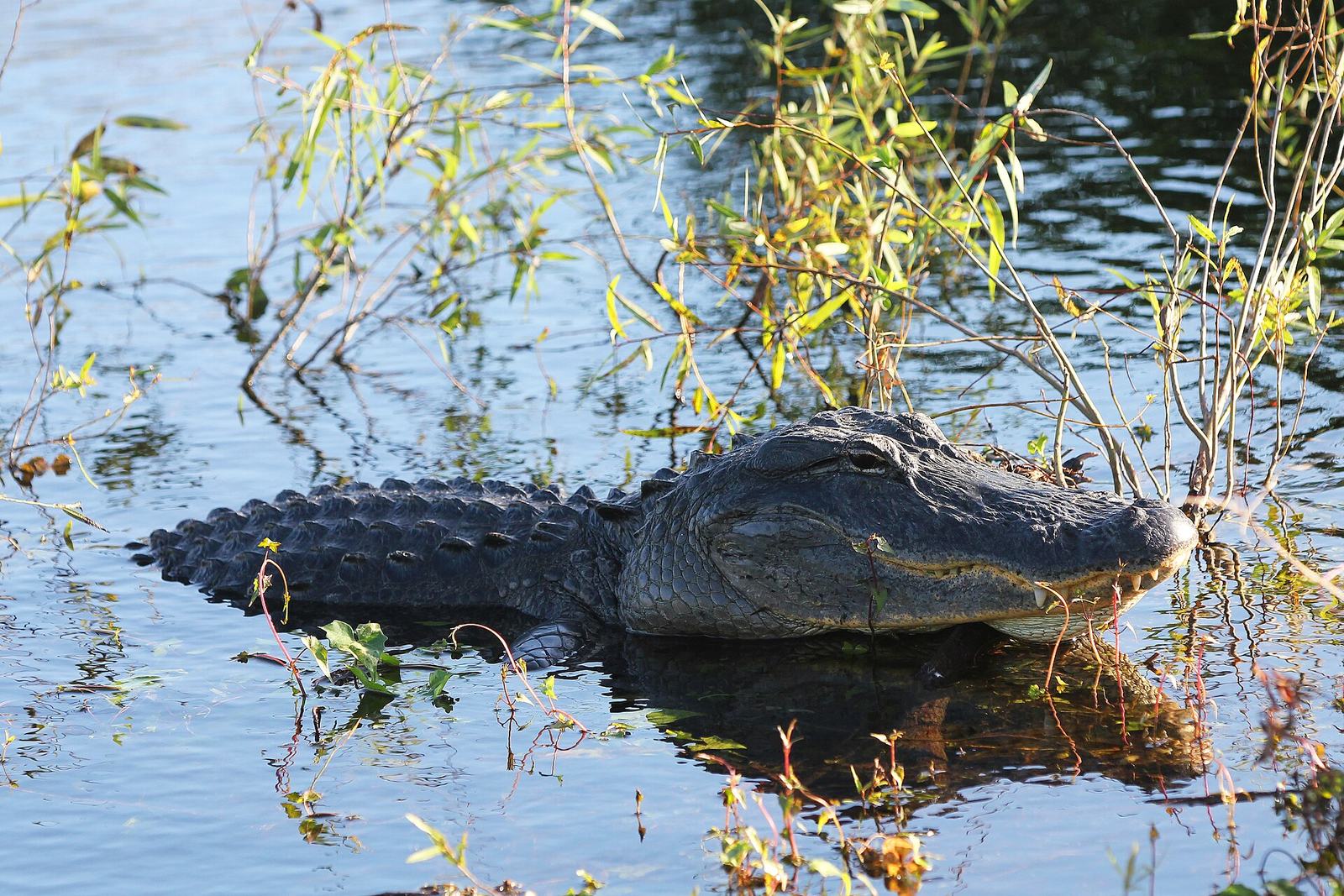
The Everglades & Biscayne — the park radius Two national parks — entrances and boats, not one gate
Strengths
- Everglades National Park is a river of grass with three distinct doors, per the Park Service: the main entrance at Ernest F. Coe, toward Homestead — for Royal Palm's boardwalks and the long road down to Flamingo; Shark Valley on the Tamiami Trail, built around a tram road and bicycles; and the Gulf Coast entrance at Everglades City. Three doors, three different days — pick by what you want the day to be
- Biscayne National Park is the mirror image — a national park that is mostly water: the Dante Fascell Visitor Center at Convoy Point is its only drive-to fragment, and the park itself — the islands, the reefs, the lighthouse side — is reached by boat, with park-partner institute programs as the structured way in
- Together they are Miami's true counterweight: an hour beyond the causeways, the trip changes from city-and-beach to subtropical wild, inside the same holiday
Watch out
- The famous airboats are not a park program: airboat tours operate commercially outside the park's boundaries, whatever their brochures imply — inside the boundary, the Park Service's own programs and concession trams are the offer, and the distinction matters for what you will actually see
- Shark Valley's tram and the parks' ranger programs run seasonal and capacity patterns — check the NPS pages for your date rather than building the day on a stranger's summer
- These are radius days, not add-ons: each entrance is its own drive from the urban core, and Biscayne's best self requires booking the boat layer ahead
Best for: one full day of a five-day trip — Everglades for most first-timers, Biscayne for boat people and repeat visitors.
See Everglades National Park →Official site See Biscayne National Park →Official siteWhich Miami day is yours?
The course in this hub's sense: layers first, then the builds. Slots, not timetables — the operators publish the patterns, and the causeways punish improvisation.
Getting around — two free systems that don't meet, and one airport spine
What about money?
Deliberately, this page states no prices — this hub's standing rule for destination courses, and Miami rewards it more than most: the city's two best transport systems are officially free, its beach is public, and its most famous street is a walk. The spending concentrates where you choose it to — the base you sleep in, the park days, the cruise itself. For worked example budgets for US trips in general, our budget calculator builds them from your trip's shape — treat every figure there as an example to adjust, not a quote — and our travel cards comparison covers paying for the trip.
Decisions that actually matter
Is Miami Beach part of Miami?
No — it is a separate city on a barrier island east of the mainland city of Miami, with its own government, streets and services (including its own free trolley). The two are joined by causeways across Biscayne Bay. It matters practically: the two cities' free transit systems do not connect, and your base choice — island or mainland — is the first real decision of the trip.
What is actually free to ride in Miami?
Two entire systems, by the operators' own statements: the Metromover, Miami-Dade Transit's automated downtown circulator (three loops, 21 stations), and the City of Miami Beach trolley (four routes across the island). Also the MIA Mover at the airport. Metrorail and Metrobus are the county's paid services — their fares are published on the county's pages, and this page states none.
Which cruise terminal do I go to?
The one printed on your cruise documents. PortMiami's terminals are line-assigned and spread along Dodge Island — Terminal AA (MSC), A (Royal Caribbean), B (Norwegian), D/E/F (Carnival), V (Virgin Voyages), J (boutique lines), C (multi-line) — and Miami-Dade County publishes an address, directions and parking page for each. With Terminal G under construction since 2025, assignments can shift; documents first, then the county's page for your terminal.
Can I visit the Everglades without a tour?
Yes — it is a national park with public entrances, and the Park Service structures the visit three ways: the main Ernest F. Coe entrance (Royal Palm and the road to Flamingo), Shark Valley on the Tamiami Trail (tram road and bicycles), and the Gulf Coast entrance at Everglades City. What you cannot do inside the park is the airboat: those tours are commercial operations outside the park boundary, distinct from the park's own programs — a difference worth knowing before you book either.
Is there a train from Miami airport to the beach or downtown?
To downtown's orbit, yes; to the beach, no. The free MIA Mover takes you from the terminal to the Miami Intermodal Center, where Metrorail's Orange Line runs toward downtown (transfer to the free Metromover loops at Government Center). The beach has no rail link: its airport connection is the Metrobus airport express bus, and every island arrival from MIA is a road leg.
Should I worry about hurricane season?
Worry is the wrong verb; checking is the right one. This coast's storm risk is seasonal and forecast-driven, so the honest guidance is procedural: check NOAA's National Hurricane Center and Miami-Dade County's own guidance for your exact dates, keep the itinerary swappable (park days and beach days trade places easily), and let official forecasts — never a guide page, including this one — call a specific week's weather.
Keep planning
Prices and terms change often — the booking site is the final word. Transit patterns, terminal assignments and works, park programs and beach conditions all change; check the operator's own page for your date. Facts on this page checked against official sources, November 2026.


